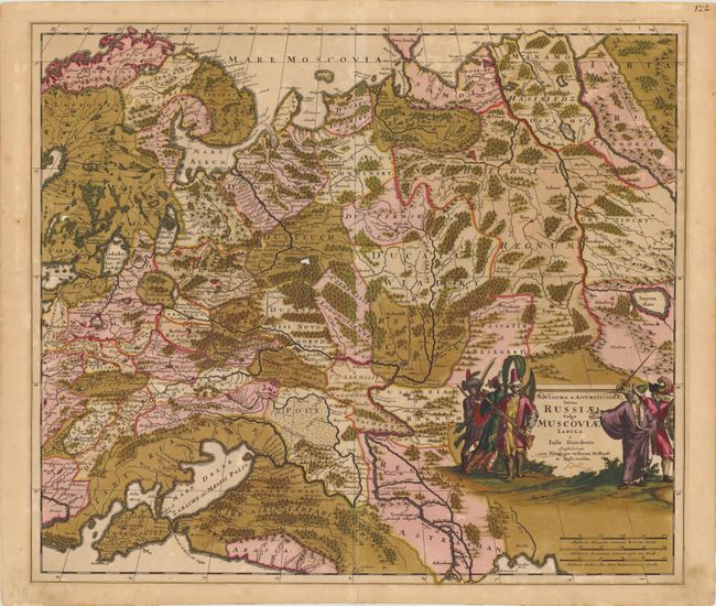
Subject: Russia
Period: 1690 (circa)
Publication:
Color: Hand Color
Size:
22.5 x 19.5 inches
57.2 x 49.5 cm
This detailed map of western and central Russia extends from Scandinavia and Novaya Zemlya in the north to the Black and Caspian seas in the south. The forests and rivers in the region are prominently featured, including the Volga and Ob Rivers. Numerous place names are also depicted, from large, fortified cities to small towns. The map is adorned with a decorative title cartouche featuring Russian soldiers.
References:
Condition: C
Original color with numerous cracks caused by the oxidation of the green pigment, some of which have been closed on verso with archival tape. There are four very small (1/8 to 1/4") areas of loss, a few tiny abrasions, and marginal soiling. This map would greatly benefit from conservation.