Subject: Northern France
Period: 1635 (circa)
Publication:
Color: Hand Color
Size:
20.5 x 14.8 inches
52.1 x 37.6 cm
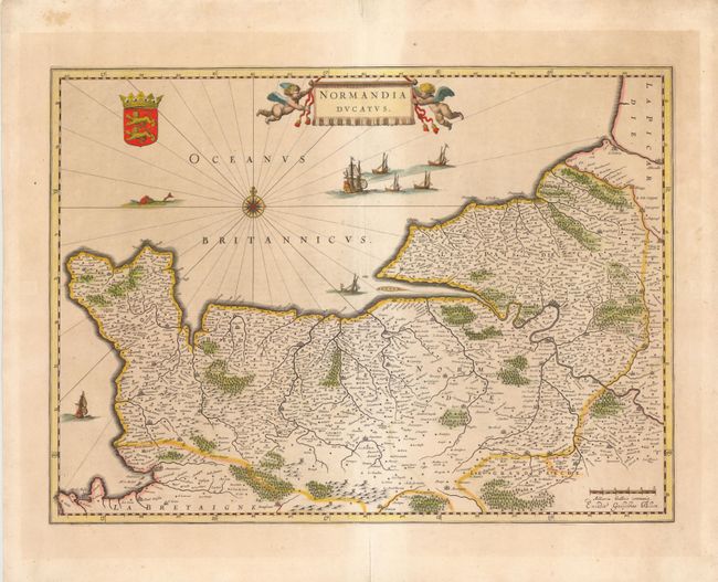
This very detailed map of the Normandy coast extends from Cherbourg and Avranches in the West to Dieppe and Rouen in the East. The map also features Caen, Le Havre, and Mont Saint Michel in the lower left corner. A compass rose, ships, fishing boats and a sea monster are depicted in the English Channel. The map is adorned with a large title cartouche flanked by putti and Normandy's coat of arms. French text on verso.
References:
Condition: B+
Wide margins with light toning and archivally repaired centerfold separations confined to blank margins. There are a couple of minor printer's creases along centerfold.