Catalog Archive
Auction 140, Lot 515

"Map of the Seat of War Between Germany and France Showing the Territory Between Berlin and Paris…", Shober, Charles

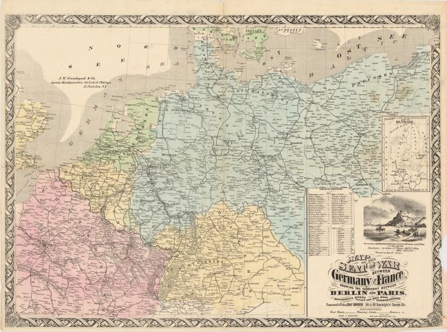
Subject: Western Europe

Period: 1871 (circa)

Publication:

Color: Hand Color

Size:
27.5 x 19.5 inches
69.9 x 49.5 cm
Download High Resolution Image
(or just click on image to launch the Zoom viewer)

This uncommon map shows the political boundaries of France and Germany during the Franco-Prussian War in 1870. While the map shows both a northern and southern Germany, the successful defeat of the French under King Wilhelm I of Prussia joined these nation states into a single unified Germany in 1871. Includes an inset of Denmark and an elegant floral border. Published by J.W. Goodspeed & Co. No copies were located in the OCLC.

References:

Condition: B

There is a chip at right with some loss of border, a few minor stains primarily at upper right, and a few minor tears and fold separations repaired on verso with archival material. Issued folding.

Estimate: $250 - $325

Unsold

Closed on 5/23/2012

Archived