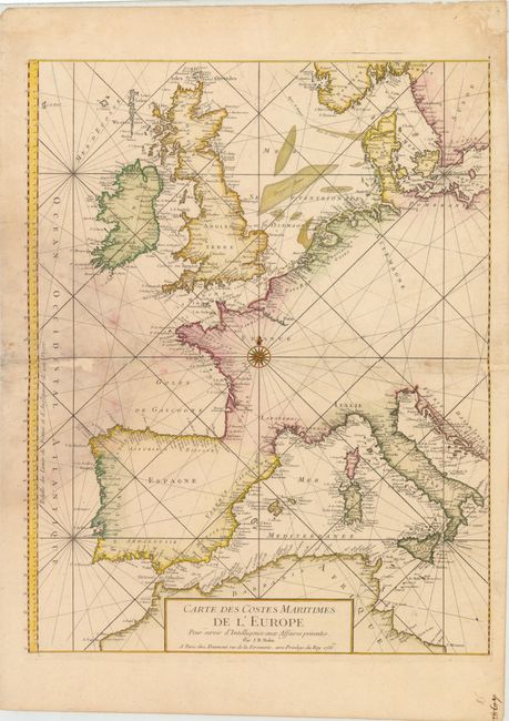
Subject: Western Europe
Period: 1756 (dated)
Publication:
Color: Hand Color
Size:
19.5 x 25 inches
49.5 x 63.5 cm
This sea chart of western Europe is centered on a large compass rose and extends to include southern Norway and Sweden and part of northern Africa. Detail is limited to the coasts, with numerous place names shown. Large sand banks in the North Sea are also prominently depicted. Printed on two sheets, joined as issued.
References:
Condition: C+
On watermarked paper with a large damp stain at left that extends along centerfold, causing several holes and some creasing, which have been archivally repaired with a minor amount of rhumb lines and border in facsimile. There are some tiny worm tracks in an unengraved area of map at far right that have been professionally infilled, and a chip in top right blank margin that has been archivally repaired.