Subject: North Sea, Low Countries & England
Period: 1750 (circa)
Publication:
Color: Hand Color
Size:
21.5 x 17.3 inches
54.6 x 43.9 cm
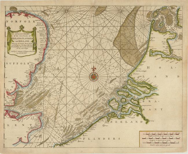
This sea chart of the southern half of the North Sea is filled with soundings and depictions of navigational hazards. The chart extends along the English coast from Rye in Kent to Holkham in Norfolk, and along the opposing shoreline from Calais in France to Harlingem in the Netherlands. Many place names are depicted along the coastlines of England, Belgium and the Netherlands. The map is adorned with a drape-style cartouche and a 16-point compass rose.
References:
Condition: B+
A long centerfold separation at top and a short separation at bottom have been professionally repaired, with a minute amount of image in facsimile. There is marginal soiling, and a few small tears and chips in blank margins have been professionally repaired.