Subject: London, England
Period: 1741 (dated)
Publication:
Color: Hand Color
Size:
22.5 x 20 inches
57.2 x 50.8 cm
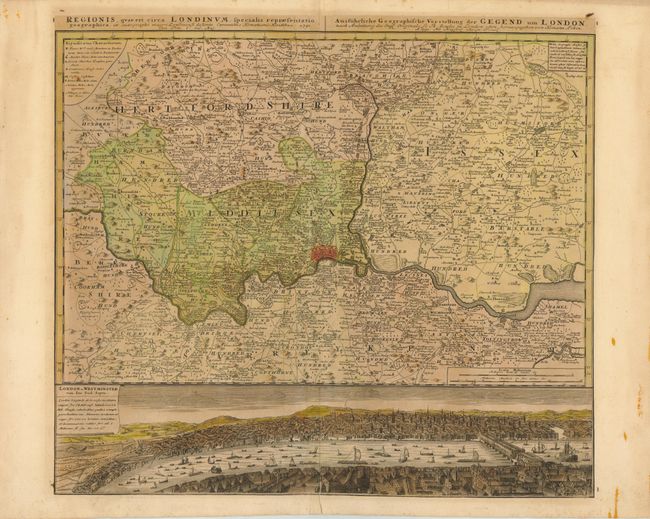
This very detailed map centered on London was originally produced by Thomas Bowles. It covers the vicinity from Maidenhead to Rochester. The map extends to include P. High Wickham, Chelmsford, Bishops Stratfort, and below Rochester. The lower quarter is a bird's-eye view of London and Westminster from Southwark from across the Thames, which is densely filled with boats and ships of all description. The legend uses icons to locate towns, market towns, parish churches, gentlemen's houses, castles, wind and water mills, and villages.
References: Howgego #88.
Condition: B
Toned with a few tiny spots of foxing and an archivally repaired centerfold separation that enters 1/2" into map image at bottom. The map has been fully remargined and has a printer's crease extending through most of the image to the left of the centerfold.