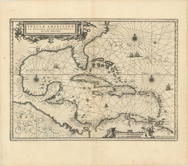
Subject: Gulf of Mexico and Caribbean
Period: 1640 (circa)
Publication: Nouvel Atlas
Color: Black & White
Size:
20 x 15 inches
50.8 x 38.1 cm
This handsome map focuses on the West Indies and covers the region from the Chesapeake through the Gulf of Mexico, with Central America and the northern part of South America. Details are confined to the coastlines. Cartographically it is based on the extremely rare chart of Hessel Gerritsz 1631, and is nearly identical to Blaeu's map of the same title. This is the first state of this map, French text on verso. Lovely title and scale of miles cartouches, rhumb lines, compass roses and sailing ships make this a very attractive map.
References: Burden #248.
Condition: B+
Nice dark impression. Clean centerfold separation has been repaired on verso, leaving one inch confined to the blank margin that is still separated but away from image. Very occasional light foxing primarily in the margins.