Subject: Southwestern United States, Texas & Mexico
Period: 1852 (dated)
Publication: Meyer's Zeitungs Groschen Atlas
Color: Hand Color
Size:
11 x 9 inches
27.9 x 22.9 cm
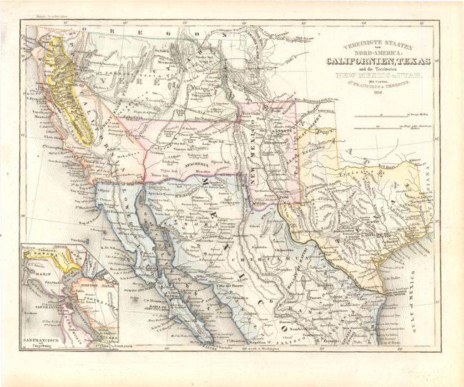
This terrific map covers the western U.S. and northern Mexico. Of special interest is a huge California Gold Region, fully colored in yellow, that stretches from about Merced north to Shasta in Northern California. Part of the southwest and California are named Upper California and the Baja is Lower California. Lake Tahoe is here called Mountain Lake, and the Great Basin is called the Great Sandy Plain. The Great Salt Lake and Utah Lake are misshapen but correctly located. Salt Lake City (here Mormon City) is incorrectly located at the southern tip of the Great Salt Lake. New Mexico is oddly shaped and contains several towns that properly belong in Mexico. There are also many interesting place names in Texas including Austin's Grant, Houston, and S. Anfelipe de Austin. The map is filled with place names, Indian tribes and wagon roads.
References: cf. Wheat (Gold) # 217
Condition: A
There are a few faint spots in the image, else fine.