Catalog Archive
Auction 140, Lot 304

"Sud Carolina. Nach des Gouverneurs von Carolina, J. Drayton's Charte (1803) reducirt", Weimar Geographisches Institut

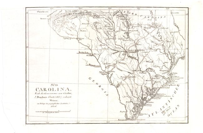
Subject: South Carolina

Period: 1806 (dated)

Publication: History of South Carolina

Color: Black & White

Size:
12 x 8.5 inches
30.5 x 21.6 cm
Download High Resolution Image
(or just click on image to launch the Zoom viewer)

This scarce German map of South Carolina is based on Governor Drayton's map of South Carolina of 1803, which appeared in Drayton's History of South Carolina. The map shows good detail of roads, towns, and rivers, and names a few Indian tribes.

References:

Condition: A

Issued folding, with light offsetting. Top margin is trimmed close to neatline, but is still adequate for framing. The bottom-left corner has been cut, far from map image.

Estimate: $275 - $350

Sold for: $170

Closed on 5/23/2012

Archived