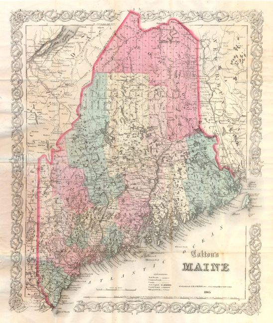
Subject: Maine
Period: 1865 (dated)
Publication:
Color: Hand Color
Size:
12.4 x 15.7 inches
31.5 x 39.9 cm
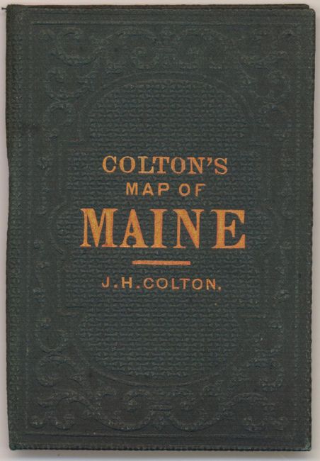
This pocket map individually colors each of the counties and depicts roads, towns and villages, rivers, railroads and topography. County boundaries are current to 1860, showing 16 counties. Printed on fine banknote quality paper, the map is surrounded with Colton's trademark strapwork border. Folds into 3.5" x 5" embossed and gilt green cloth boards. The original paper label on the inside front cover advertises Colton's other maps and atlases.
References:
Condition: B+
There are a few tiny spots in the image and a small chip at left, confined to the blank margin. A few fold intersections are reinforced on verso with archival tape.