Subject: Wyoming, Idaho and Utah
Period: 1877-78 (dated)
Publication:
Color: Black & White
Size:
33 x 24.5 inches
83.8 x 62.2 cm
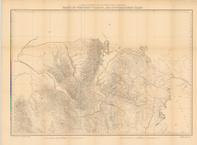
A. Parts of Western Wyoming and Southeastern Idaho. This topographical map is centered on today's Jackson Hole, Wyoming and extends to show good detail of Jenny and Leigh lakes, but the area of Yellowstone National Park is completely blank despite having been established in 1872. Other place names include John Gray's Lake, the Blackfoot River, Caribou Mt., Fremont's Pk. and To-gwo-tee-a Pass. It provides a detailed examination of the Snake River and Blackfoot Range in Idaho as well as the Gros Ventre Mountains and part of the Wind River Range in Wyoming. Condition - there are a few fold separations and short splits repaired with archival tape on verso and some faint toning along the folds. (B)
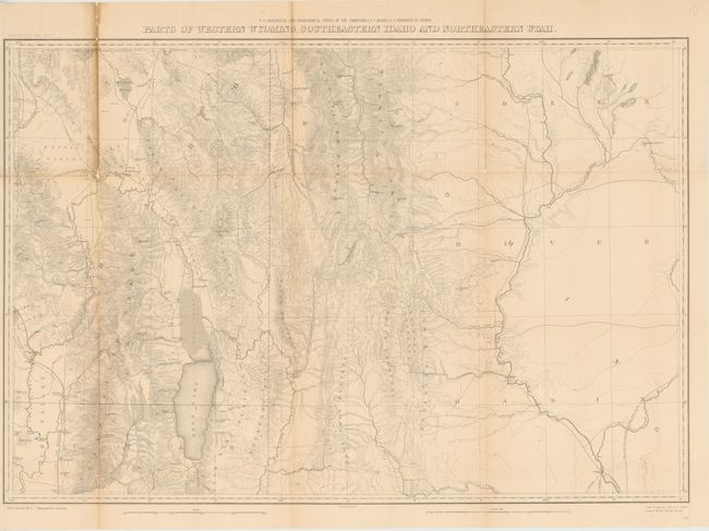
B. Parts of Western Wyoming, Southeastern Idaho and Northeastern Utah. Very detailed sheet depicting the land between the Green River Basin in the east and the Bear River Range in the west, extending south below Bear Lake to Logan. The Aspen Range, Salt River Range and the Wyoming Range in the north are shown, as well as Fremont's Lake and numerous settlements. Condition - there is a fold separation repaired with tissue on verso and two small splits at fold intersections. Light toning along the folds. (B)
References: Wheat (TMW) #1296.
Condition: B
See descriptions.