Catalog Archive
Auction 140, Lot 192

"Sketch Indicating the Advancement of the Surveys of the Public Lands and the Military Topographical and Geological Surveys West of the Mississippi", Wheeler, George (Lt)

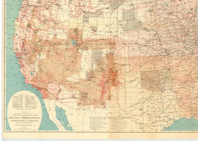
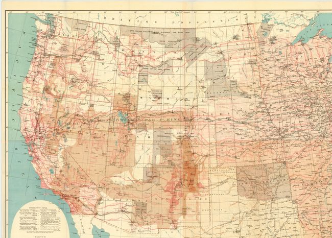
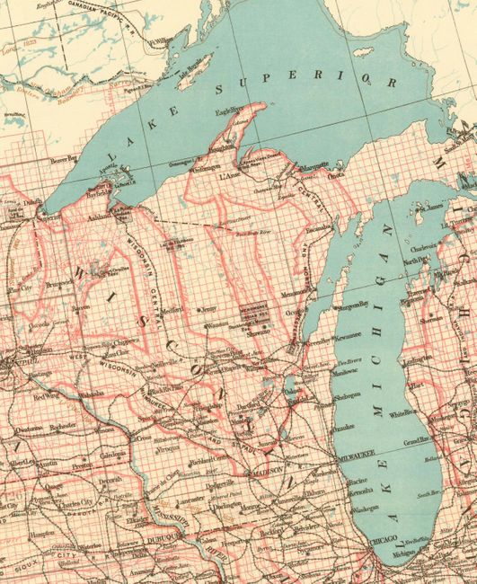
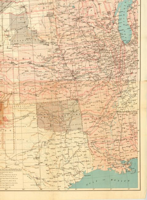
Subject: Western United States

Period: 1879 (dated)

Publication:

Color: Printed Color

Size:
44.3 x 32.5 inches
112.5 x 82.6 cm
Download High Resolution Image
(or just click on image to launch the Zoom viewer)

Beautifully lithographed in four colors with impressive detail throughout. The map locates more than 130 forts and camps (many flying tiny American flags), nearly 70 Indian reservations, the routes of dozens of early explorers, completed and projected railroads with their land grants, and dozens of Spanish land grants noted. Survey details plotted include base lines, meridians and townships. Wheeler's surveying efforts are shown as shaded regions. Map consists of four joined sheets.

References: Cohen pp. 192-194.

Condition: B+

The map is clean and bright with a few tiny splits and folds separations that are repaired on verso with archival tape. Issued folding.

Estimate: $350 - $450

Sold for: $250

Closed on 5/23/2012

Archived