Subject: Western United States
Period: 1857 (published)
Publication: U.S. and Mexican Boundary Survey, Vol. I
Color: Hand Color
Size:
23.3 x 20.3 inches
59.2 x 51.6 cm
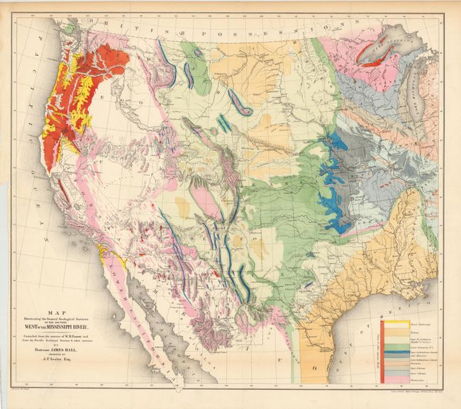
This great map of the western United States was one of the first geological maps of the region. It illustrates the many mineral resources that helped spur westward migration and expansion. The legend uses color to identify twelve geological formations. The map is also filled with terrific detail of mountains, watersheds, cities and roads. It covers the country from the Ohio River Valley to the Pacific and extends to include the states of Sonora and Chihuahua in Mexico. The political divisions include the large western territories of Washington, Oregon, Utah, New Mexico, Nebraska and Kansas. Drawn by Thomas Jekyill. Lithographed by Sarony, Major & Knapp, 449 Broadway, New York.
References: Marcou & Marcou #52; Wheat [TMW] #922; Blevins Wyoming #76.
Condition: B+
A nice example with bright original color. There is a binding trim at left with a resulting binding tear that extends 2" into the image that has been closed on verso with archival tape and an extraneous crease at lower left that has been reinforced with archival tape on verso.