Subject: Western United States
Period: 1852 (dated)
Publication: Auswanderungs-Atlas fur Nord Amerika
Color: Hand Color
Size:
12 x 15.3 inches
30.5 x 38.9 cm
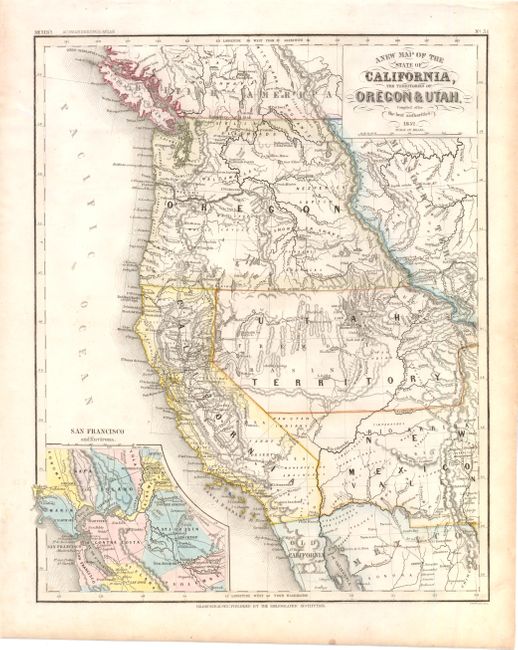
An interesting map of the new state of California and the large western territories based on the important Mitchell series. The map is filled with interesting information, notably, the exploration routes of Lewis and Clark, Fremont, Kearney, and Cooke, and the Spanish and Oregon Trails. Oregon Territory, with Oregon City as its capital, has its eastern boundary in the Rocky Mountains adjoining Missouri Territory. Utah Territory extends to Old Park and Long's Peak in present-day Colorado. New Mexico Territory encompasses parts of Colorado, Nevada and Arizona and displays a pre-Gadsden Purchase border along the Gila River. Only a few counties are delineated in California and the capital is at San Jose. A large inset shows San Francisco and Environs, which includes much of the Gold Region. It is this unique inset that differentiates this from the Mitchell map. From Meyer’s Auswanderungs-Atlas (Emigration Atlas), this map was targeted to the large number of German immigrants that flooded into the United States in the aftermath of the March Revolution of 1848.
References:
Condition: A
A few minor spots, else fine.