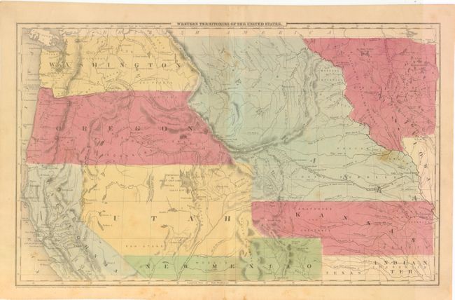
Subject: Western United States
Period: 1847 (dated)
Publication:
Color: Hand Color
Size:
17.5 x 10.5 inches
44.5 x 26.7 cm
This is a great map showing the transitional boundaries of the American West. Oregon and Washington Territories are massive, stretching all the way from the Pacific to the Rocky Mountains at the Continental Divide. The wide Utah Territory reaches across to a newly formed Kansas Territory, and the huge Nebraska Territory extends from Canada's border down to Kansas. Minnesota is a large territory as well, which includes a vague Dacotahs region that extends to the Missouri River. A Mormon settlement is noted on the Great Salt Lake - this is one of the earliest maps to note that fact, as Joseph Smith and his followers had just settled in this region in 1847.
References:
Condition: B
Original color with toning, some light scattered spots, and the centerfold is reinforced with archival tape.