Subject: Colonial Southeast
Period: 1780 (dated)
Publication: Political Magazine
Color: Black & White
Size:
15 x 10.8 inches
38.1 x 27.4 cm
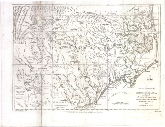
This scarce map of the Carolinas, published during the American Revolution, is apparently based on Henry Mouzon's 1778 foundation map of the region. It is filled with topographical notes and the locations of important plantations, court houses, meeting houses, swamps, and chapels. This map illustrates the region involved in the southern theater of the war. After General Clinton seized Charleston in May of 1780, the British began a campaign into the Carolinas in pursuit of the remnants of the Continental Army. The map illustrates the Battle of Camden in August, 1780, where the American General Gates was defeated by British General Cornwallis.
References: Jolly #POL-16.
Condition: B
Issued folding, now pressed with light soiling. There are several fold separations, tears, extraneous creases and small holes along left-hand fold that have all been closed on verso with archival materials, with minute loss of image.