Subject: Eastern Canada - Atlantic Ocean
Period: 1764 (dated)
Publication:
Color: Hand Color
Size:
31.5 x 20.8 inches
80 x 52.8 cm
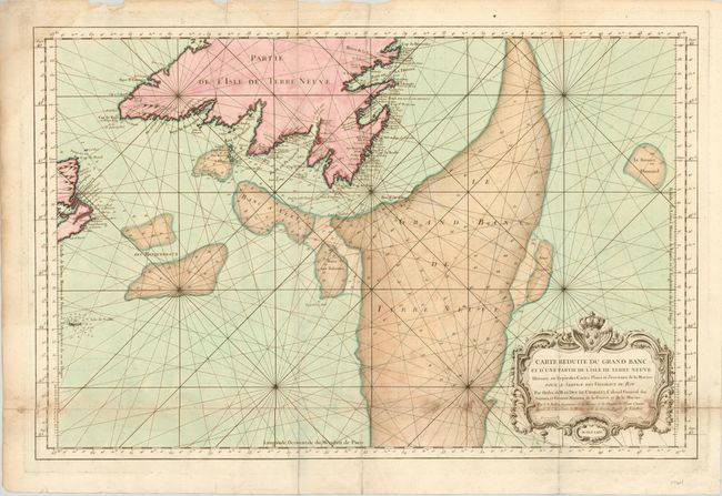
This attractive sea chart focuses on the fish-rich Grand Bank, as well as the smaller banks located off the coasts of Newfoundland and Cape Breton. The chart is filled with rhumb lines and soundings for the banks, in addition to the approaches to the southern coast of Newfoundland, the eastern coast of Cape Breton and Sable Island. The map is decorated with a fine cartouche wreathed with flowers and topped by the crest of the King of France. Printed on two sheets, joined as issued.
References:
Condition: B
Strong impression on thick watermarked paper. There are some scattered stains and light toning where the two sheets were joined. There are a few short tears in blank margins, and fold separations at top and bottom, one of which just enters map border.