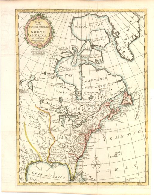
Subject: Eastern North America
Period: 1779 (circa)
Publication: A Philosophical and Political History…
Color: Hand Color
Size:
9.5 x 12.5 inches
24.1 x 31.8 cm
This map covers the eastern part of North America from Greenland to Florida with settlement confined to the eastern seaboard. Numerous Indian names are noted throughout. A comment by L. Ouinipigon alludes to a Northwest Passage: "R. of ye Assenpouels supposed to fall into the Western Ocean." The map is adorned with a garland style title cartouche and compass rose. This map appeared in both the 1779 and 1784 editions of Abbe Raynal's A Philosophical and Political History of the Settlements and Trade of the Europeans in the East and West Indies.
References: McCorkle #779.9.
Condition: B+
Issued folding, now pressed with light offsetting. There is a binding trim at right, but still ample room for framing.