Subject: Colonial North America and Caribbean
Period: 1770 (circa)
Publication:
Color: Hand Color
Size:
22.8 x 18.8 inches
57.9 x 47.8 cm
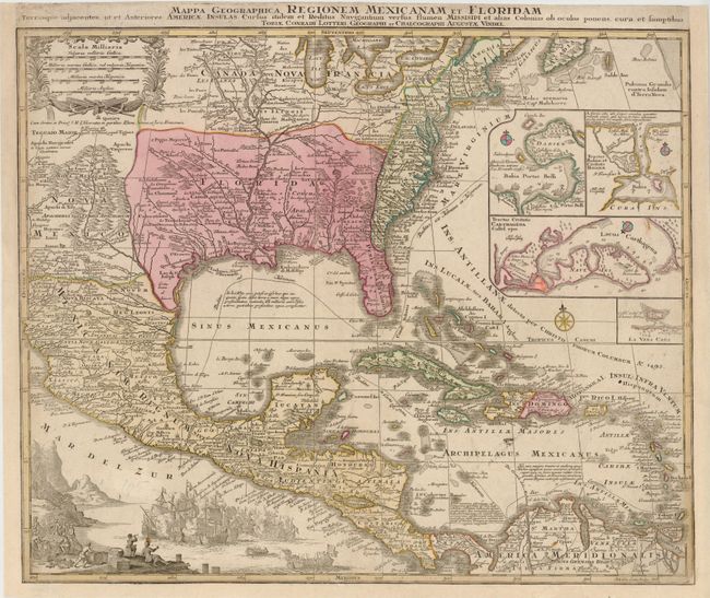
This is one of the many versions of Delisle's important map of 1703 (Carte du Mexique et de la Floride). It provides a view of North America from the Great Lakes through the West Indies. The British colonies are confined east of the Appalachian Mountains, France controls the Mississippi Valley and Florida, and Spain possesses Mexico; political divisions as dictated by the Treaty of Utrecht in 1713. New Mexico is finely described with many native tribes and pueblos noted, including Acoma, Santa Clara, and Isleta. While geographically nearly identical to Delisle's chart, this map is very decorative with the lower left corner filled with a huge sea battle and the Atlantic filled with four inset plans of Panama, Havana, Carthagena and Vera Cruz. Engraved by Tobias Conrad Lotter and first published by Lotter’s father-in-law, Matthais Seutter, this edition was published by Lotter after he inherited the plate in 1758.
References: Martin & Martin, plt. 18.
Condition: B
Professionally remargined on three sides with a small amount of neatline in facsimile. There are a few minute worm holes in an unengraved area of map and some small stains in image.