Subject: Western Hemisphere
Period: 1833 (dated)
Publication:
Color: Hand Color
Size:
23 x 20.8 inches
58.4 x 52.8 cm
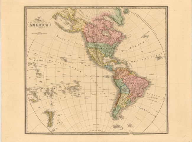
This handsome, large map shows the United States and Mexico with early borders. Texas is still part of Mexico and is unnamed while the boundary between the United States and Canada is drawn to present-day boundaries. The map extends through the Pacific Ocean to include New Zealand and the Pacific Islands where Hawaii is prominently shown. In South America, there is still a remnant of Lake Parime. In the Antarctic Icy Sea, and just peaking out of the border are the South Sandwich Islands, labeled Sandwich Land and Southern Thule.
References:
Condition: A
Nice strong impression on thick paper with a hint of offsetting, else fine.