Subject: Western Hemisphere
Period: 1748 (circa)
Publication:
Color: Black & White
Size:
17.5 x 13.8 inches
44.5 x 35.1 cm
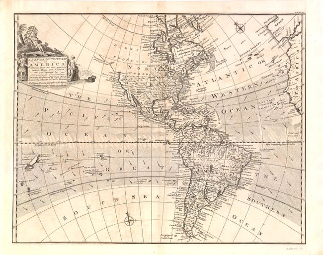
The attractive map of the Americas illustrates the Course of the Trade Winds in Both the Atlantic and Pacific Oceans. In North America, the Pacific Northwest is left open, completely blank and labeled Parts Undiscovered. The coastline stops in the vicinity of Alaska with the notation The Supposed Straits of Annian. The British colonies are shown east of the Appalachian Mountains, with French Louisiana sandwiched between them and the Spanish possession of New Mexico. The only settlements named in the West are Cenis in Texas, Santa Fe and Alamillo in New Mexico, and Casa Grande in Arizona. A very large Lake Superior is shown to contain several islands. In South America, the Amazon River is well delineated but the mythical Xarayes L. still appears as the headwaters for the Rio de la Plata. The map extends from the Salomon Islands in the Pacific to the coastlines of Spain and Africa. The decorative cartouche features Native Americans and wildlife with a treasure chest and a group of European merchants in the background.
References:
Condition: B+
Nice example with a sharp impression. Left and right margins have been remargined with the left neat line partially in facsimile. Very faint offsetting, else very good.