Subject: Atlases
Period: 1722 (dated)
Publication:
Color: Hand Color
Size:
11.5 x 16 inches
29.2 x 40.6 cm
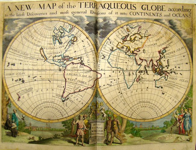
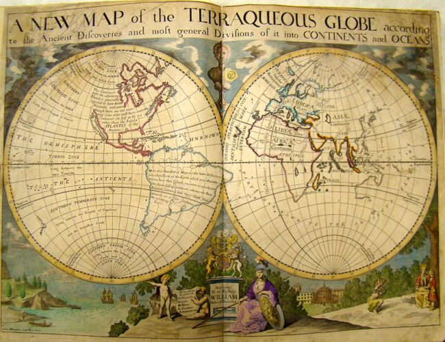
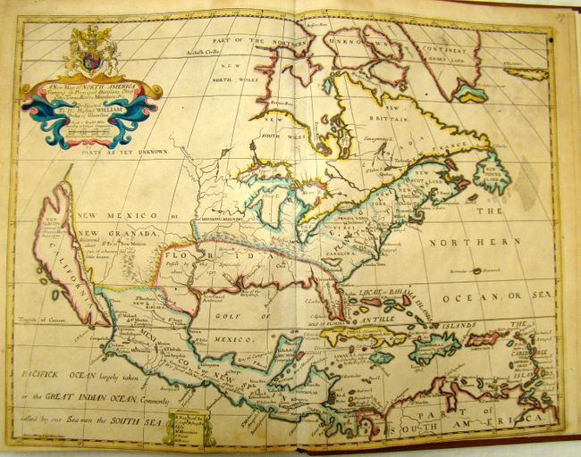
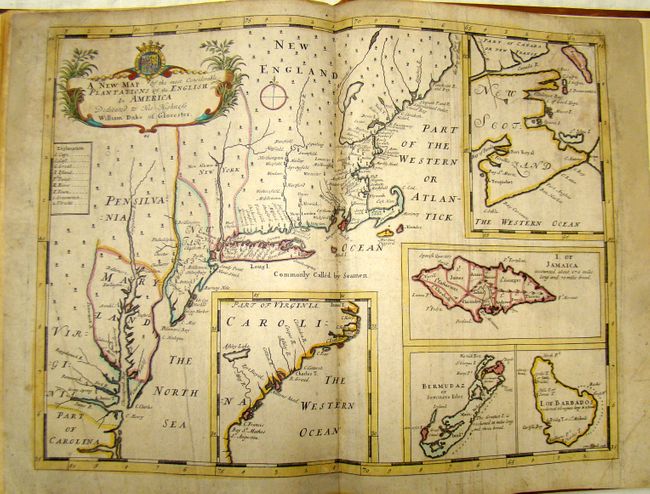
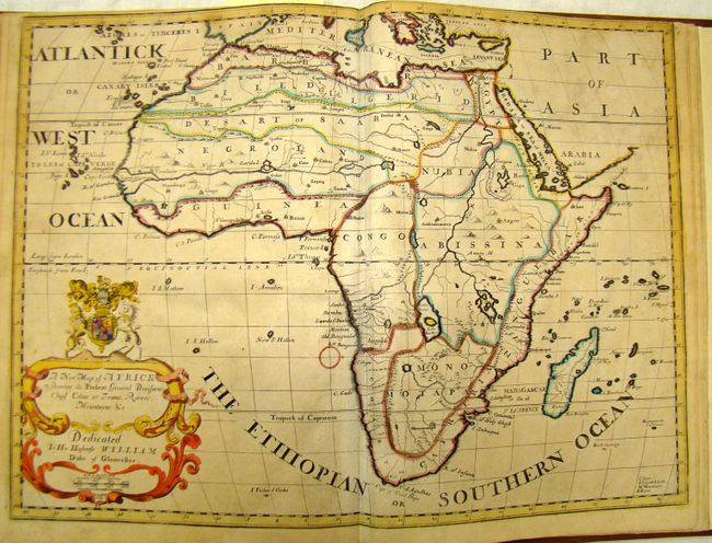
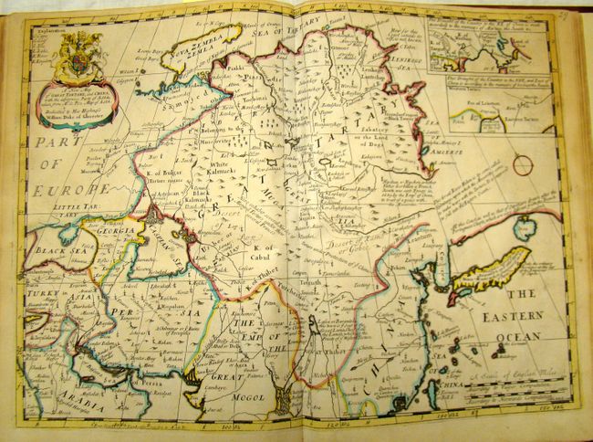
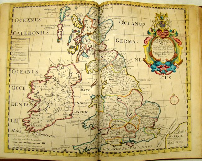
This rarely offered folio atlas is complete with 41 double-page copper engraved maps by the Oxford engravers M. Burghers, R. Spofforth, Benjamin Cole and Sutton Nichols. The map collation agrees with the "Catalogue of Maps" page. The atlas contains, in most cases, two of each map to compare the ancient and modern configurations. The two world maps feature the island of California, a partially explored Australia, and numerous notations of parts as yet undiscovered. The Americas stand on their own, with a single map each for North America and South America, as well as one for the English Plantations in America. The map of North America also depicts the island of California and Florida encompasses the entire south. Each map is on thick hand laid paper and carries a dedication "To his Highness William Duke of Gloucester." The maps are highly decorative, with elaborate title cartouches surrounded by coats of arms, putti, or allegorical figures. This edition is identical to the first edition of 1700 save the date on the title page.
The Oxford scholar Wells produced these maps for the education of his young pupil William, Duke of Gloucester, the son of Queen Anne and George, Prince of Denmark. William suffered from encephalitis and died in 1700 at the age of eleven. Wells dedicated and published the atlas as a tribute to the Duke. A magnificent, complete early 18th Century atlas.
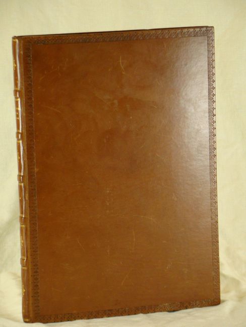
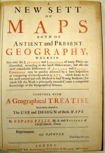
Large folio, beautifully rebound in full calf with embossed borders on covers and raised bands with gilt on spine. Title page, list of maps, and 41 double-page, full color maps.
References: Phillips (A) 3479.
Condition: B+
Most of the maps are very good, with minor soiling primarily in blank margins. A few maps are in good to satisfactory condition, with some soiling and close trimming with some loss of neatline. Three maps (ancient world, present world, and Europe) have been backed in Japanese tissue to repair several tears at left and right. Covers have light scuffing. Overall a very good example.