Catalog Archive
Auction 139, Lot 703

"A Map Comprehending Bherings Straits, with the Adjoining Coasts of Asia & America", Trusler, John

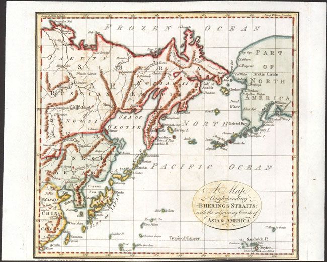
Subject: North Pacific Ocean

Period: 1789 (dated)

Publication: The Habitable World Described…

Color: Hand Color

Size:
8.3 x 7.8 inches
21.1 x 19.8 cm
Download High Resolution Image
(or just click on image to launch the Zoom viewer)

This small map extends from just below the Tropic of Cancer to north of the Bering Strait. It shows an early depiction of Alaska and numerous towns, rivers and mountains are shown in Asia and Russia. Alaska, named Part of North America, is largely blank with the exception of a few coastal names. A note below the Sandwich Islands states "where Capn. Cook was killed." Engraved by Neele.

References: Falk #1789-26; McCorkle (18th C. British & American Geography Books) #389.

Condition: B+

A dark impression with light offsetting. Trimmed close to neatline at bottom, with loss of publisher's imprint.

Estimate: $120 - $150

Sold for: $75

Closed on 2/15/2012

Archived