Catalog Archive
Auction 139, Lot 657

"Plan de Batavia", Fer, Nicolas de

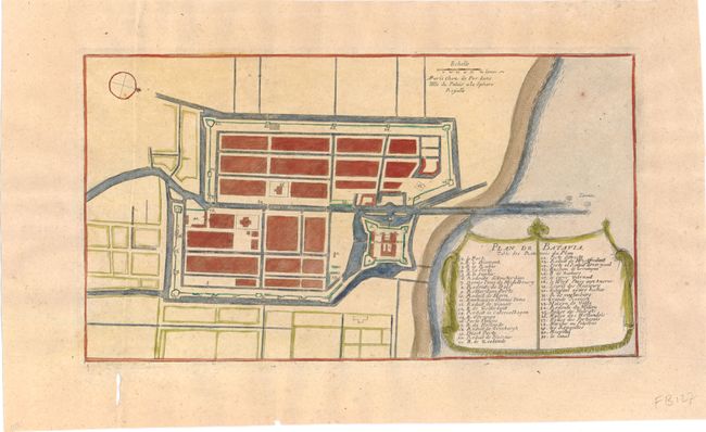
Subject: Jakarta, Indonesia

Period: 1696 (circa)

Publication: Les Forces de l' Europe…

Color: Hand Color

Size:
11.5 x 6.3 inches
29.2 x 16 cm
Download High Resolution Image
(or just click on image to launch the Zoom viewer)

Charming bird's-eye plan of the city of Batavia (Jakarta), the Dutch colonial capital. The chart is oriented with north to the lower right by a simple compass rose. The title and key cartouche appears in drape form, and identifies 41 locations. Published by Nicolas de Fer, Geographer at Louis XIV's court, and one of the most prolific publishers of plans of European cities in the late seventeenth century.

References: Pollak p. 40.

Condition: A

Faint toning with a few small holes in wide, blank margins.

Estimate: $110 - $140

Sold for: $80

Closed on 2/15/2012

Archived