Subject: Southeast Asia
Period: 1662 (dated)
Publication:
Color: Hand Color
Size:
22.5 x 18 inches
57.2 x 45.7 cm
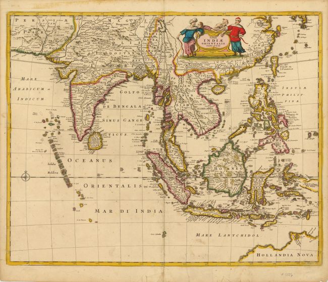
This beautiful map of Southeast Asia was engraved by Joannes Lhulier. The map extends from southeastern Persia to Formosa (Taiwan), the Philippines, and northern Australia. The many islands and major ports are clearly depicted. The map illustrates the sphere of influence of the Dutch East India Company (VOC) which had built a great trading empire throughout the region in the seventeenth century. Ships coming into Batavia (Jakarta) from the Netherlands carried supplies for VOC settlements in Asia. Silver and copper from Japan were used to trade with India and China for silk, cotton, porcelain and textiles. These products were either traded within Asia for the coveted spices from the Spice Islands or brought back to Europe. This map served as the prototype for Speed's map of the East Indes.
References:
Condition: B+
Lovely original color with a professionally repaired centerfold separation that enters 2.5" into map image at bottom. There are some additional short tears in bottom and left blank margins that have been professionally repaired, with one that enters 1" into map image at bottom. Remnants of hinge tape on verso.