Subject: Southeast Asia
Period: 1636 (circa)
Publication:
Color: Hand Color
Size:
19 x 15.5 inches
48.3 x 39.4 cm
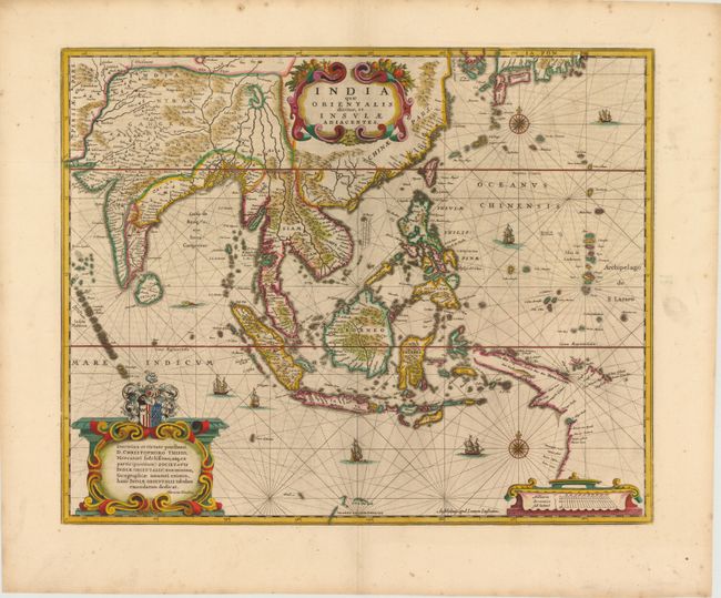
This handsome chart of Southeast Asia was one of a number of maps that Henricus Hondius and Jan Jansson issued in their continued rivalry with the Blaeu firm. It is nearly identical to Blaeu's map of the same title, except the cartouches are more restrained and there is a single place name missing near 't Landt van d'Eendracht (Australia) at bottom center. The map presents one of the most detailed images of the sphere of operations of the trading empire of the Dutch East India Company. It extends from India to New Guinea and parts of northern Australia, and north to the southern coast of Japan with a portion of Korea, which is named as an island. It delineates a more correct outline of New Guinea and shows the discoveries made by the Dutch in the Gulf of Carpentaria. It is dedicated to the wealthy Dutch merchant, Christophoro Thisio. The map is beautifully decorated with sailing ships, cartouches and compass roses. Latin text on verso.
References: Suarez (SEA) p. 202.
Condition: A
Lovely color and wide margins with a small hole that just enters map image at top right.