Subject: Jerusalem, Holy Land
Period: 1716 (circa)
Publication:
Color: Hand Color
Size:
18 x 12.1 inches
45.7 x 30.7 cm
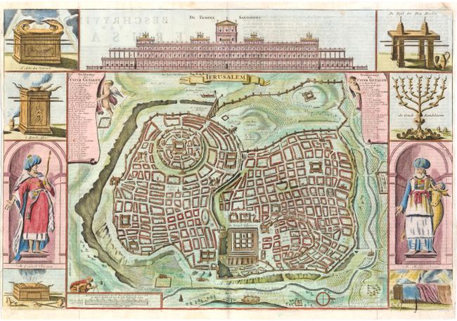
Great bird's-eye plan of ancient Jerusalem after Juan Bautista Villalpando's plan. Engravings of temple vessels, religious icons, Solomon and a high priest flank the plan. At the top is a large elevation of the Temple of Solomon. This map was originated by Bastiaan Stoopendaal in 1688, and then revised by Daniel Stoopendaal. Daniel Stoopendaal's imprint is illegible and a crack appears in the plate at bottom right. Dutch text on verso.
References: Poortman & Augusteijn #143-KII2.
Condition: B
There is slight show-through of text on verso and a light impression. Issued folding, now pressed with a tiny worm hole along the fold at left. A tear that enters image 1.5" at right and a small chip in left margin that just enters neatline, have both been repaired on verso with old paper.