Catalog Archive
Auction 139, Lot 576

"Carte de l'Hellespont ou Canal des Dardanelles…", Barbie du Bocage, Jean Denis
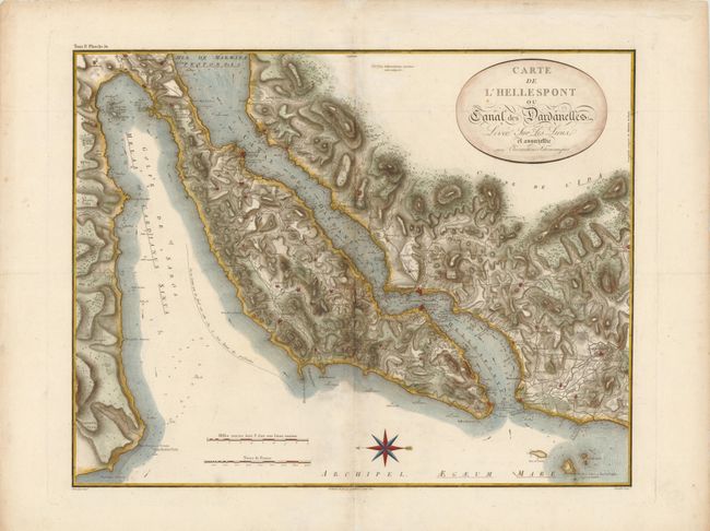
Subject: Turkey

Period: 1821 (circa)

Publication:

Color: Hand Color

Size:
21.3 x 16.8 inches
54.1 x 42.7 cm
Download High Resolution Image
(or just click on image to launch the Zoom viewer)

This navigational chart of the Dardanelles details both the land and the waters. The land is finely engraved with topography, roads and miniature bird's-eye plans of cities. The waters are filled with soundings, currents and navigational notes. Hellespont was the ancient name of this narrow strait. It was so called from Helle, after the daughter of Athamas, who drowned in the strait.

References:

Condition: B+

Watermarked paper with wide margins, minor soiling, and a tiny repaired worm hole in unengraved area of map image. There are a few light creases, some of which have been reinforced on verso with archival materials.

Estimate: $230 - $275

Sold for: $170

Closed on 2/15/2012

Archived