Subject: Transylvania, Romania
Period: 1724 (dated)
Publication:
Color: Hand Color
Size:
19.5 x 17.8 inches
49.5 x 45.2 cm
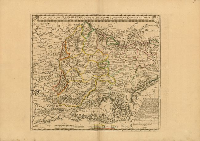
This detailed map of Transylvania is bounded in the east and south by the Carpathain mountain range. As the title indicates, the region is divided into five nationalities, the Hungarians, Saxons, Sicules (from Sicily), Moldaves (from Moldavia), and Valaques (from Wallachia, Romania), which are identified in a key at bottom. An inset at right describes the region, including the climate, topography, main cities, and religions represented. This map was based on the work of Cantelli da Vignola and was first published in 1705. This edition was published by Guillaume Danet, De Fer’s son-in-law and successor.
References:
Condition: B+
Original outline color with wide margins and light toning along centerfold. Some light offsetting in blank margin at right, and marginal soiling.