Subject: Netherlands
Period: 1697-1709 (circa)
Publication:
Color: Hand Color
Size:
22.8 x 20 inches
57.9 x 50.8 cm
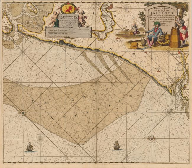
This sea chart of the coast of the Netherlands extends from Texel to Rotterdam, and as far inland as Amsterdam, with east oriented at the top. Large cities are depicted with miniature panoramic and bird's-eye views. The waters are filled with soundings and depictions of shoals. The large title cartouche features a Dutch man sitting next to wheels of cheese and a woman churning butter, and the scale of miles cartouche includes van Keulen's imprint and two cherubs. The map is further adorned with two sailing ships and two compass roses.
References:
Condition: A
Original color with gilt highlights, on double-thick paper as issued. There are a few faint spots and a light horizontal crease, still overall very good.