Subject: Britain
Period: 1749 (dated)
Publication:
Color: Hand Color
Size:
21.3 x 18.5 inches
54.1 x 47 cm
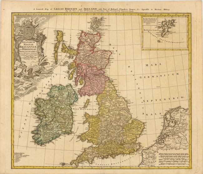
This handsome map of the British Isles includes very good detail of Ireland, England, Scotland, Wales, and the island groups of Orkney and the Outer Hebrides. The map extends to include the adjacent parts of Holland and Belgium with five distance scales below. At upper right the inset chart details the Shetland Islands. A key at lower left includes symbols for cities, towns, villages, universities, forts and redoubts. The large, ornate title cartouche is decorated with a sea monster, shells, a coat of arms and the accoutrements of battle. Titled in English along the top of the map.
References:
Condition: B+
Nice impression on watermarked paper. There is some light even-age toning and the lower right blank margin has been reinforced with old paper to repair a small tear away from the image.