Subject: Southern South America
Period: 1750 (circa)
Publication:
Color: Hand Color
Size:
18.8 x 19 inches
47.8 x 48.3 cm
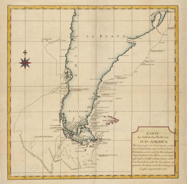
This handsome chart shows the route of Capt. George Anson's expedition from St. Catherine's Island off the coast of Brazil, around Cape Horn and up to Juan Fernandes Island (now known as Robinson Crusoe Island) off the coast of Chili. This chart shows numerous calculations of water depth, ocean currents, and includes navigational notes.
During the War of Jenkins' Ear, Anson set sail in 1740 in command of a squadron sent to attack Spanish possessions and interests in South America. The expedition was ill-equipped and failed to carry out its original ambitious mission. By June 1741 when Anson reached Juan Fernandes, his force had been reduced to only three of the original six ships, while the strength of his crews had fallen from 961 to 335. After recuperating on the island, he collected the remaining survivors on his flagship, the Centurion, and set sail in search of one of the richly laden galleons that conducted the trade between Mexico and the Philippines. The indomitable perseverance he had shown during one of the most arduous voyages in the history of sea adventure gained the reward of the capture of an immensely rich prize, the Nuestra Señora de Cabadonga, which he encountered off Cape Espiritu Santo on June 20, 1743.
References:
Condition: B+
A fine impression with light soiling and several extraneous creases that have been reinforced with tissue on verso.