Subject: Chile
Period: 1635 (circa)
Publication: Atlas Maior
Color: Hand Color
Size:
19 x 14 inches
48.3 x 35.6 cm
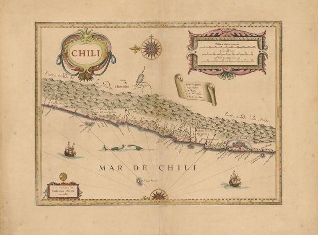
This striking map covers the known coastal region of Chile from approximately Antofagasta in the north to Cabo Gallegos in the south. The map is oriented with north to the left with two bold compass roses. The Andes are shown prominently, with two live volcanoes in the vicinity of Villarrica. Beyond the mountains, in what is now Argentina, is a large unnamed (and nonexistent) lake with the cities of Mendoza and San Juan - with San Juan incorrectly placed to the south of Mendoza. Otherwise, the map is surprisingly accurate for its age with many recognizable place names: La Serena, S. Iago (Santiago), Concepcion, Valdivia and the Gulf of Ancud are all located. It is beautifully adorned with three large cartouches, a scroll-style key, ships and sea monsters.
References:
Condition: B+
Watermarked paper with wide margins and a few tiny tears along centerfold that have been repaired with archival materials. There is a faint printer's crease and a tiny repaired hole to the left of center. A couple of short tears in blank margins have also been repaired with archival materials.