Catalog Archive
Auction 139, Lot 332

"The Island of Barbadoes. Divided into its Parishes, with the Roads, Paths, &c. According to an Actual and Accurate Survey", Moll, Herman
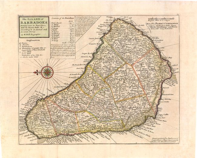
Subject: Barbados

Period: 1745 (circa)

Publication: Atlas Minor

Color: Hand Color

Size:
14.5 x 11.5 inches
36.8 x 29.2 cm
Download High Resolution Image
(or just click on image to launch the Zoom viewer)

Bold copper engraved chart shows the island fully engraved and filled with towns and villages, roads, mills, plantations, political divisions, and many coastal details. A very decorative compass rose places north to the left. Contained in the title cartouche is a legend and a list of the eleven parishes, each with their population. Note at upper center gives a brief history of Barbados from the reign of King James I. Moll notes at upper right that "This Pocket Companion Contains all ye Roads or Paths, Towns, Churches, Fortifications and Plantations…" Printed for Thomas Bowles and John Bowles.

References: Campbell, Tony (MCC-21) #24.

Condition: B+

Issued folding, now pressed with a few folds reinforced on verso with tissue, and light toning.

Estimate: $275 - $350

Sold for: $200

Closed on 2/15/2012

Archived