Catalog Archive
Auction 139, Lot 326

"Carte Reduite de l'Isle de la Jamaique pour Servir aux Vaisseaux du Roy…", Bellin, Jacques Nicolas
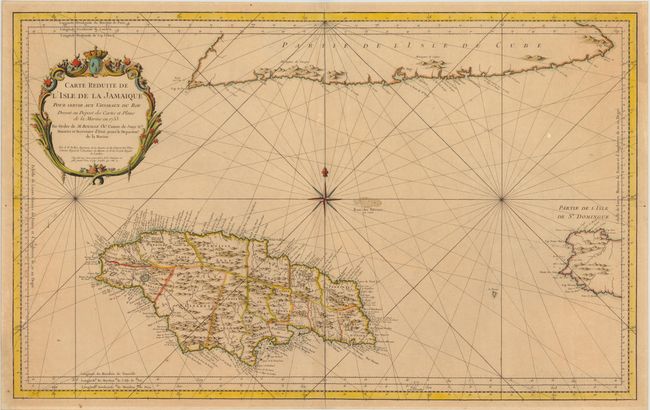
Subject: Jamaica

Period: 1753 (dated)

Publication: Hydrographie Francoise…

Color: Hand Color

Size:
34.5 x 21.5 inches
87.6 x 54.6 cm
Download High Resolution Image
(or just click on image to launch the Zoom viewer)

Superb, large-scale sea chart of Jamaica that is politically divided into parishes and centered on an eight-point compass rose. The map includes remarkable detail with scores of place names and safe anchorages along the coast, in addition to mountains, roads, personal estates, watershed and other details in the interior. Part of the southern coast of Cuba and the western tip of Hispaniola (Haiti) are also shown. A large decorative rococo-style cartouche further enhances the chart.

References: Kapp (MCC-42) #66.

Condition: B+

A nice impression on sturdy paper. Lightly toned with a couple of insignificant spots.

Estimate: $500 - $650

Sold for: $350

Closed on 2/15/2012

Archived