Subject: Caribbean
Period: 1721 (published)
Publication: A New General Atlas…
Color: Hand Color
Size:
24 x 20 inches
61 x 50.8 cm
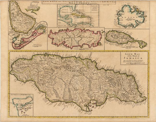
An uncommon large map with eight maps on a single sheet. The major map is of Jamaica with its parishes and very fine detail and notations throughout and an inset map of Port Royal harbor. Arrayed at top are maps of Barbados (with an inset of Bridgetown), the entire West Indies, Antigua, St. Kitts, Tobago and Bermuda. This is a revised version of Christopher Browne's map of 1690 with Senex's imprint in title. Engraved by J. Harris.
References: Shirley (BL Atlases) T.SEN-2a, #32; Palmer, M. (MCC-19) #26; Kapp, K.S. (MCC-42) #41.
Condition: B
Original color on watermarked paper with light toning, a few faint spots, and a binding trim close to neatline at top. There are a few short cracks and fold separations that have been closed on verso with Japanese tissue, and a couple of minute unrepaired cracks in the map of Tobago.