Subject: Caribbean
Period: 1630 (circa)
Publication: Nieuwe Wereldt ofte Beschrijvinghe van West-Indien…
Color: Black & White
Size:
14 x 11 inches
35.6 x 27.9 cm
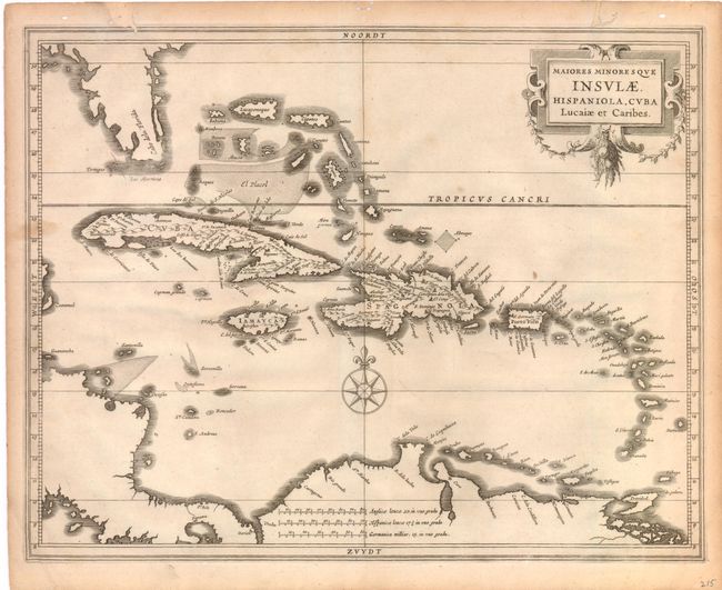
Hessel Gerritsz was intimately involved with Dutch expansion into the Americas at the beginning of the seventeenth century. He was the official cartographer of the Dutch East India Company and thus was privy to the latest cartographic information coming into Holland. He traveled to the New World to gather much of the information used to produce maps in collaboration with Johannes de Laet, one of the directors of the Dutch West India Company, who was also involved with Dutch colonial efforts. The map covers from Florida, here called Cabo dela Florida, and the Bahamas through to Trinidad and is embellished with a garland draped title cartouche and a compass rose. Gerritsz' map of the Caribbean served as a model for other cartographers throughout the rest of the century.
References:
Condition: B
Two worm tracks that just enter map border at top have been closed on verso with old paper and there are some tiny worm holes in blank margins.