Subject: World
Period: 1681 (published)
Publication: Geographiae Universalis…
Color: Hand Color
Size:
5 x 4 inches
12.7 x 10.2 cm
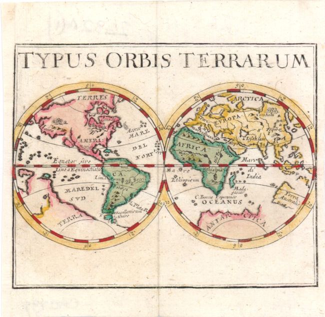
While not containing a lot of detail, this miniature map includes several interesting errors that illustrate a still evolving cartographic picture of the world. In North America, the Great Lakes are only partially formed, and a large lake in the west spawns a river that flows into the Pacific between the mainland and the island of California. The huge landmass of Iesso fills the North Pacific and several disjointed coastlines occupy the South Pacific. The northern coast of East Asia is severely truncated and Korea is shown as an island. Unusually, the Nile River appears to rise from a single large lake south of the equator, rather than the Ptolemaic concept of twin lakes. Only the western and northern coastlines of Australia are depicted, and Antarctica appears as a very large continent.
Pierre Duval was Nicolas Sanson's nephew and pupil. He published a wide range of atlases and individual maps including a fine miniature world geography with many of the maps based on Sanson. This map is from the German edition of Duval's world geography. The maps were probably engraved by Sigismund G. Hipschman (as his signature appears on the title page and the larger world map) and have Latin titles rather than the original French. The maps are often attributed to Johann C. Beer, who translated the work into German.
References: Shirley #478; King (2nd ed.) pp. 144-45.
Condition: A
Professionally remargined at left.