Subject: Gulf of Mexico and Caribbean
Period: 1705 (circa)
Publication: A New Voyage Round the World
Color: Hand Color
Size:
11 x 6 inches
27.9 x 15.2 cm
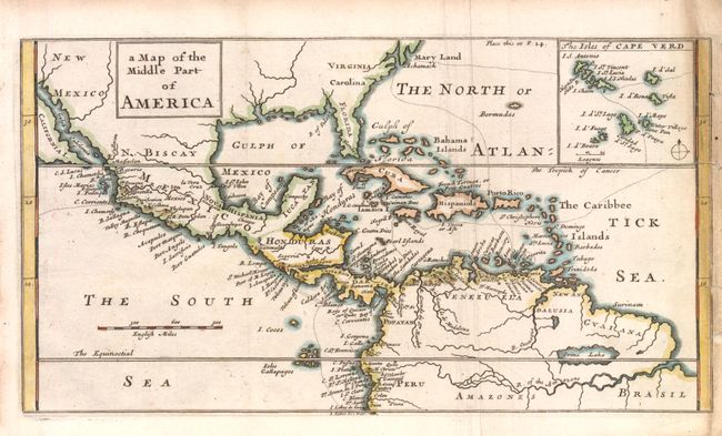
This chart shows part of the route of William Dampier's first circumnavigation voyage in the 1680s with his passage across the isthmus of Panama. The map covers the area of northern South America through Central America into what is now the southern United States with Maryland, Virginia, Carolina, Florida, and New Mexico named. There is an inset map detailing the Cape Verde islands with the route of exploration delineated. On the map, California is an island although only the southern portion is shown. Not noted in McLaughlin.
References:
Condition: B
Nice impression with some light toning along the right margin. There are a couple of marginal tears and chips in the binding side margin affecting the border and including minor loss of neatline. Issued folding.