Catalog Archive
Auction 139, Lot 304

"A Map of the Isthmus of Darien, & Bay of Panama", Moll, Herman
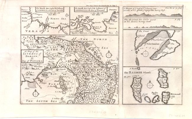
Subject: Panama

Period: 1710 (circa)

Publication:

Color: Black & White

Size:
10.3 x 6.3 inches
26.2 x 16 cm
Download High Resolution Image
(or just click on image to launch the Zoom viewer)

This unusual small map illustrates part of William Dampier's first circumnavigation voyage in the 1680s. The large map depicts the Isthmus and Bay of Panama. Two smaller maps show the Caribbean coastline of Panama west of Portobello and the Pacific coastline from the Gulf of Chiriqui to the Gulf of Panama. Two small maps and two coastal views at right depict the Bashi Islands near Taiwan, Con Son Island (Pulo Condore) off the southern coast of Vietnam and the coastline near Manila in the Philippines.

References:

Condition: B+

The map is backed with old paper to reinforce two small fold separations.

Estimate: $100 - $140

Sold for: $75

Closed on 2/15/2012

Archived