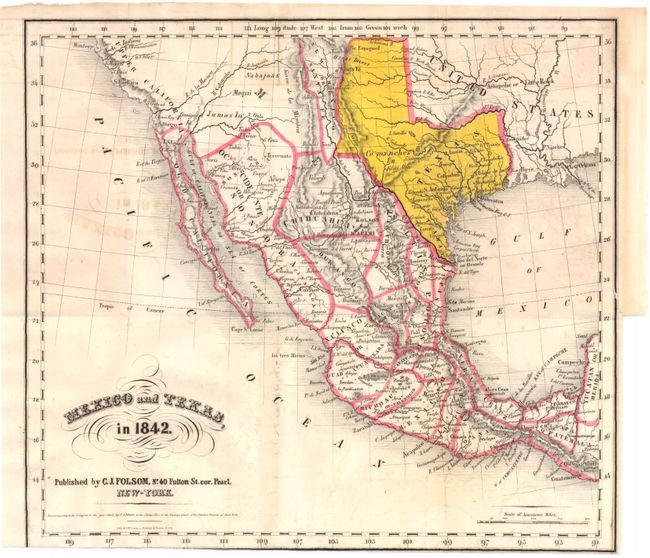
Subject: United States, Texas & Mexico
Period: 1842 (dated)
Publication: Mexico in 1842…
Color: Hand Color
Size:
10 x 9 inches
25.4 x 22.9 cm
This small map of the southwestern United States shows an independent Republic of Texas and Mexico, with political states delineated. The Comanche Indians are located in west Texas, along with the Jumas (Yuma) and Nabajoas (Navajo) in Upper California. The Republic of Texas is presented in a strange configuration with a tall, broad panhandle terminating at the Arkansas River and the southwestern border following the Rio Grande and Pecos rivers rather than just the Rio Grande. The map is particularly noteworthy for the profusion of small towns shown in Texas. Lithographed by G.W. Lewis.
References: Howes #F226; Wagner-Camp 91
Condition: B+
There is light offsetting in the image and a binding trim at bottom with some loss of neatline. Issued folding.