Catalog Archive
Auction 139, Lot 279

"Map of Washington", Wangersheim, William
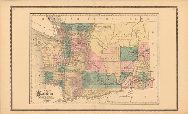
Subject: Washington

Period: 1890 (dated)

Publication:

Color: Hand Color

Size:
25.8 x 16.3 inches
65.5 x 41.4 cm
Download High Resolution Image
(or just click on image to launch the Zoom viewer)

This is an uncommon map of Washington, which was admitted as a state in November, 1889 making this one of the earliest maps to show the area as a state. The map delineates counties, displays the progress of surveying and locates Indian reservations, railroads and rivers.

References:

Condition: A

A few tiny spots in the image, else fine.

Estimate: $200 - $250

Sold for: $220

Closed on 2/15/2012

Archived