Catalog Archive
Auction 139, Lot 276

"Map of the Country Between Richmond and Petersburg Drawn from Surveys Made by Order of Maj. Gen. J. F. Gilmer Chief Engineer. C. S. A.", Gilmer, Jeremy Francis

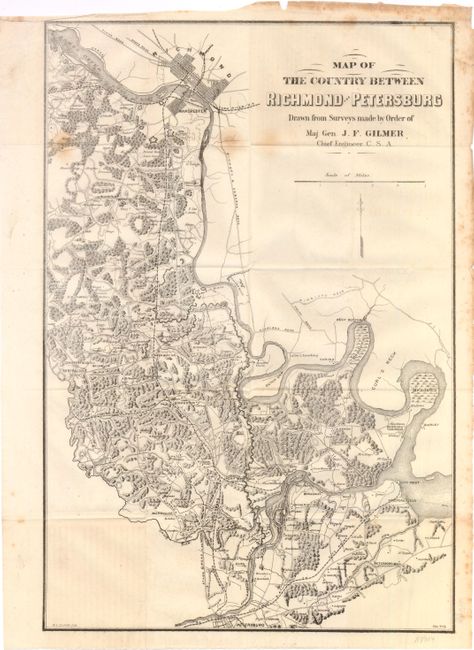
Subject: Virginia, Civil War

Period: 1866 (circa)

Publication: Life and Campaigns of General Robert E. Lee

Color: Black & White

Size:
13 x 18 inches
33 x 45.7 cm
Download High Resolution Image
(or just click on image to launch the Zoom viewer)

This is an uncommon map by Major General Gilmer, who was in charge providing detailed maps for use by the Confederate Army. It is a good example of the painstaking detail his surveyors gathered, covering an area 22 miles x 16 mile wide. Richmond and Manchester are located at top with Petersburg at bottom. Rail lines lead from Petersburg to City Point at the confluence of the Appomattox and James Rivers. Numerous fortifications are shown along with locations of residents, towns and railroads. This edition was copied from Gilmer’s original and lithographed by H. L. Penfield of New York.

References:

Condition: B

There are a few light stains below Richmond and in the upper margin. Issued folding on thin paper.

Estimate: $300 - $375

Sold for: $220

Closed on 2/15/2012

Archived