Subject: Virginia
Period: 1862 (dated)
Publication:
Color: Black & White
Size:
19 x 21.3 inches
48.3 x 54.1 cm
The Office of Coast Survey is the oldest U.S. scientific organization, dating from 1807 when Congress directed that a "survey of the coast" be carried out. By 1836, it was called the U.S. Coast Survey and in 1878, the name was changed to the U.S. Coast and Geodetic Survey. Today the Office of Coast Survey is a division of the National Oceanic and Atmospheric Administration NOAA.
The survey teams, composed of civilians as well as Army and Naval officers, charted the nation's waterways and produced a wide array of reports, survey charts, hydrographic studies of tides and currents, astronomical studies and observations, and coastal pilots. These charts are an important record of the changing nature of the nation's coastlines. In additional to coastal charts, the U.S. Coast and Geodetic Survey produced land sketches, Civil War battle maps, and the early aeronautical charts.
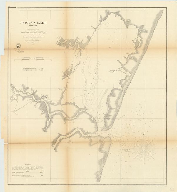
This is a detailed coastal chart of Metompkin Inlet, located in Virginia on the Atlantic coast of the Delmarva Peninsula. There is detailed information on creeks, soundings and tides.
References:
Condition: B
Some toning along the folds with two fold separations extending slightly into image, one of which has been repaired with archival tape.