Subject: New Mexico
Period: 1900-1910 (circa)
Publication:
Color: Printed Color
This lot of four maps from the early 20th century covers a period of significant growth in New Mexico including:
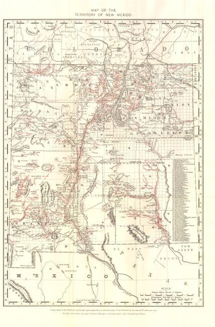
A. Map of the Territory of New Mexico, circa 1900, (13" x 20"). Lists 80 different mining districts and 18 counties. Overprinting in red to show springs and irrigations ditches. (A)
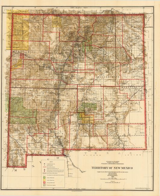
B. Territory of New Mexico, dated 1903, (18" x 21.8"). Shows numerous land divisions including 24 counties. Condition - a few pinholes, else fine. (A)
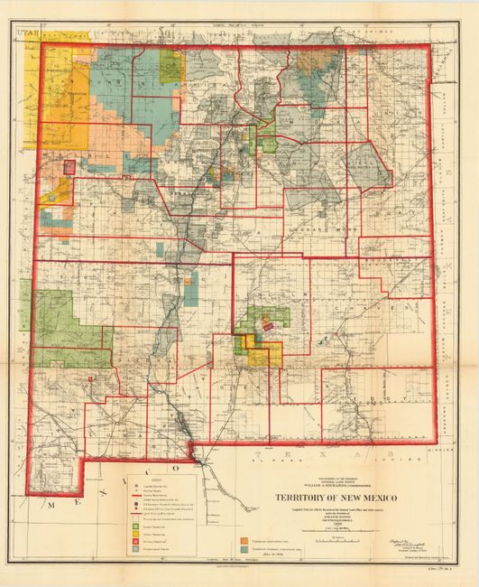
C. Territory of New Mexico, dated 1906, (18.3" x 22"). Same map as above with different coloring, showing the location of coal deposits and potential deposits. Condition - there is a 4" fold separation with archival tape on verso to reinforce a few folds. (B)
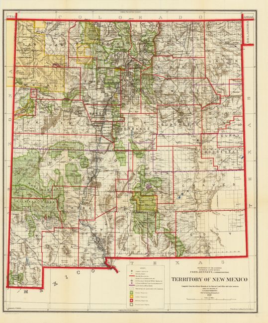
D. Territory of New Mexico, dated 1910, (18" x 21.8"). A further evolution of the territory, displaying 26 counties, 7 shy of the current 33. (A+)
References:
Condition:
See descriptions. All issued folding.