Subject: Lake Superior, Michigan
Period: 1847 (circa)
Publication:
Color: Hand Color
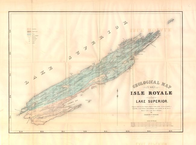
A. Geological Map of Isle Royale Lake Superior by Charles T. Jackson, (21" x 14.8"). This is an early edition of Jackson's important geological map that locates sandstone, conglomerate and trap formations and delineates copper veins as well as copper and silver mines. A scale below title converts chains to miles. Fancy title lettering. Condition - moderate offsetting in the image, issued folding. (B)
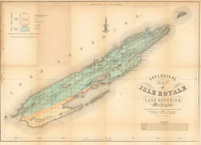
B. Geological Map of Isle Royale Lake Superior, Michigan by Foster/Whitney, (24.8" x 17.5"). Though also dated March 1st 1847, this is an updated version of the map above, completed after J.W. Foster and J.D. Whitney took over the Survey of the Mineral Lands of Michigan in 1850. It has more detail and locates Sandstone, Conglomerate and "Trap: Basalt, Porphyry" formations with three different colors. Legend keys Mines, Abandoned Mines, and Mineral Land Supposed to Contain Copper. Condition - scattered foxing and toning. Issued folding (B+)
References: Karpinski (MI) #764; Marcou & Marcou #363
Condition: B+
See descriptions.