Subject: Nantucket, Massachusetts Bay
Period: 1854 (dated)
Publication:
Color: Black & White
The Office of Coast Survey is the oldest U.S. scientific organization, dating from 1807 when Congress directed that a "survey of the coast" be carried out. By 1836, it was called the U.S. Coast Survey and in 1878, the name was changed to the U.S. Coast and Geodetic Survey. Today the Office of Coast Survey is a division of the National Oceanic and Atmospheric Administration NOAA.
The survey teams, composed of civilians as well as Army and Naval officers, charted the nation's waterways and produced a wide array of reports, survey charts, hydrographic studies of tides and currents, astronomical studies and observations, and coastal pilots. These charts are an important record of the changing nature of the nation's coastlines. In additional to coastal charts, the U.S. Coast and Geodetic Survey produced land sketches, Civil War battle maps, and the early aeronautical charts.
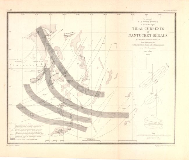
A. Tidal Currents of Nantucket Shoals,11 x 8.7". Small map showing the sea surrounding Nantucket Island. There is extensive detail of shoals, sea depth and currents demonstrating the navigational challenges in the area. A condition.
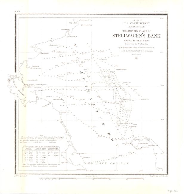
B. Preliminary Chart of Stellwagen's Bank Massachusetts Bay, 8.3 x 8.8". This chart covers an area approximately 45 miles square in the Massachusetts Bay. Boston and Boston Harbor are at left. Cape Cod is at lower right. A table of notes and
abbreviations is at the lower left. Condition - a hit of toning along the neatline at right, else very good. (B+)
References:
Condition:
See descriptions.