Subject: Connecticut and Rhode Island
Period: 1758-95 (circa)
Publication:
Color: Black & White
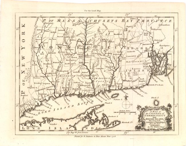
A. A Map of the Colonies of Connecticut and Rhode Island… by Thomas Kitchin, from London Magazine, dated 1758, (9.3" x 7"). This is the first printed map to depict primarily these two colonies and shows towns and villages, roads and rivers throughout. The township designations are not found on any other maps. Kitchin probably used the Survey of Gardner and Kellock (1737) as the source for this map. It is finely engraved and drawn on a scale of approximately 16 miles to the inch. The map is embellished with a decorative title cartouche, distance scale and simple compass rose. Condition - Excellent condition, Issued folding. (A+)
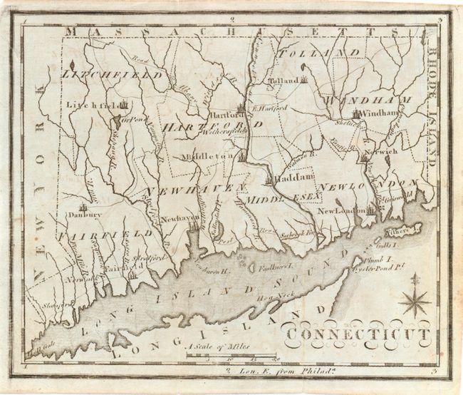
B. Connecticut by Joseph Scott, circa 1795, (7.3" x 6"). This map isn't as detailed as Kitchin's but still displays county boundaries and highlights cities, wagon roads and rivers. Condition - faint offsetting, else very good. Issued folding. (B+)
References: Jolly LOND-135; McCorkle #C758.1; Sellers & Van Ee #805; Thompson #14; Wheat & Brun #285.
Condition:
See descriptions.