Subject: Colorado
Period: 1881 (published)
Publication: Atlas of Colorado
Color:
Size:
35.3 x 25.5 inches
89.7 x 64.8 cm
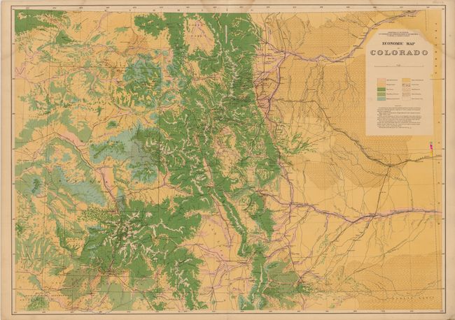
This lot includes two maps from the seminal Hayden survey. It was conducted from 1873 to1876, and first published in 1877 with an updated edition in 1881 that showed completed and projected railroads. Rich with detail, Hayden’s map are considered the best mapping of the period and laid the foundation for the mapping of Colorado.
A. Economic Map of Colorado, printed color. This is a beautifully executed chromolithographed map that details the land types of the region. The map covers the area from North Park in the north to Ft. Garland in the south, and extends from Mt. Peale in the west to Ft. Lyon in the east. A color/style legend identifies land types including agricultural and pasture lands, forest and bad land. Coal lands, and gold and silver districts are identified.
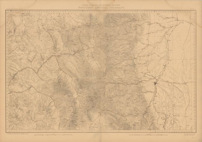
B. Northern Central Colorado, black & white. This is a topographical map very similar in geography to the map above. There is extensive detail of relief using contour lines, and both existing and proposed railroads are noted. Scale of 4 miles to the inch with contour intervals at 200 feet.
References:
Condition: B+
Each map has three small damp stains in the upper portion of the image, else very good.