Subject: Western United States
Period: 1856-57 (dated)
Publication:
Color: Black & White
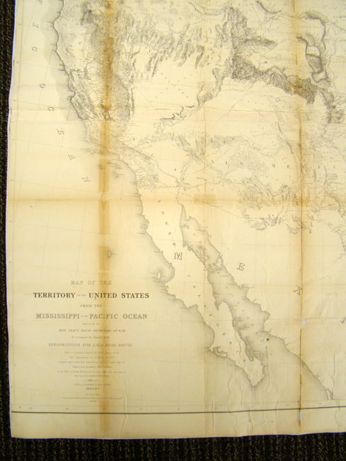
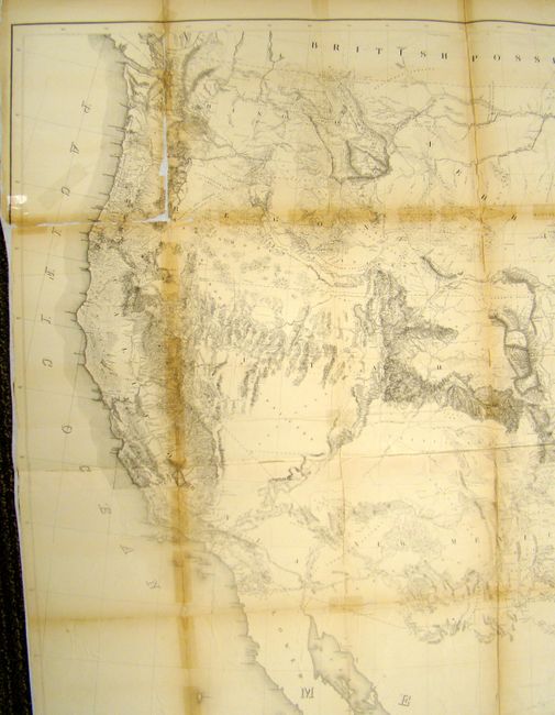
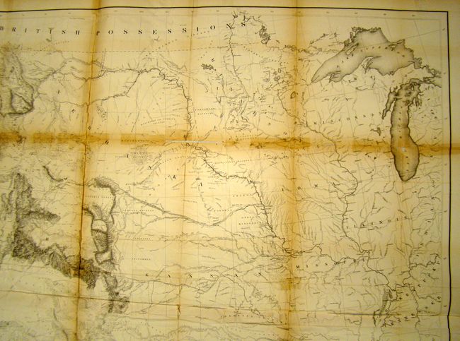
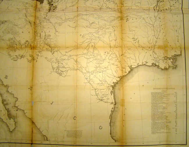
A. Map of the Territory of the United States from the Mississippi to the Pacific Ocean, (46 x 42"). Known as "Warren's General Map," this is a monumentally important map that is considered to be the first accurate overall picture of the region. Wheat considered it so important that he dedicated eight pages to its description and called it the most important map produced by the Topographical Engineers. Drawn on the polyconic projection, the map culminated a half-century of government explorations beginning with Lewis & Clark. Only 24 years old when assigned the task, Warren used information from the U.S. Land Office, the Coast Survey, Topographical Engineers, the Adjutant General, the Quartermaster General, the Indian Bureau, and Smithsonian Institution to obtain the latest information in developing this map. The majority of the map was completed by 1854, but it was not fully complete when the first railroad survey report was published in 1855 and thus did not accompany all editions. A remarkable and scarce map that represents the best geological knowledge of the day.
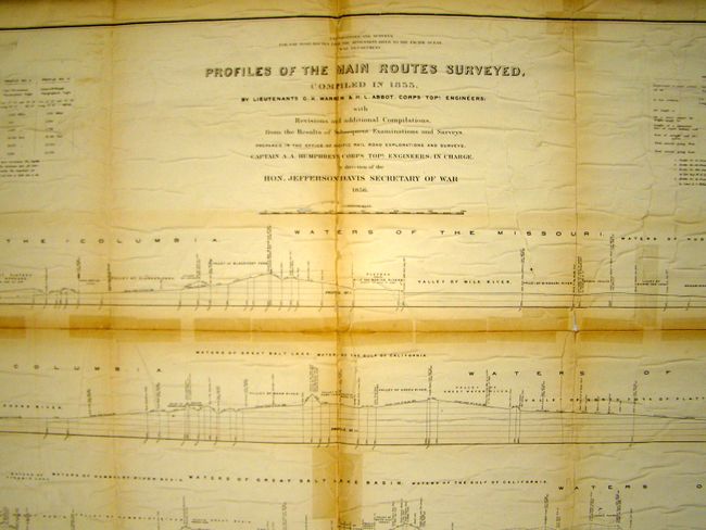
B. Profiles of the Main Routes Surveyed, (47 x 53"). This unique chart shows a profile view of the surveyed areas for the Pacific Railroad. There are 12 different profile views including those along the Mississippi, Missouri, and Columbia Rivers as well as the Pacific. There is an inset of the existing railroad routes along the Allegheny mountains showing a stark contrast in the elevation changes of the proposed western routes, emphasizing the challenge of constructing a transcontinental railroad.
References: Wheat (TMW) #936; Cohen pp. 172-5.
Condition: C+
Both were issued folded and are now mounted on linen to help strengthen and repair some paper loss along the folds. Staining and toning along the folds.